Professors

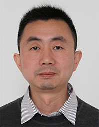
Jing Linhai received the B.S. degree in geological exploration from the Shandong Institute of Mining Technology in 1994 and the master degree in mapping and cartography from the Institute of Remote Sensing Applications (IRSA), Chinese Academy of Sciences (CAS) in 1997. He received the Ph.D. degree in Earth and Space Science and Engineering from the York University, Canada, in 2008. he worked in geomatics and remote sensing as a post-doctoral fellow in the York University from 2008 to 2011. He worked in IRSA, CAS from 1997 to 2001, and in the Center of Remote Sensing and Digital Earth (CEODE), the Institute of Remote Sensing and Digital Earth (RADI), and the Aerospace Information Research Institute, CAS from 2012. Prof. Jing was elected to the Hundred Talent Program of CAS in 2011. His current study focuses on high-resolution remote sensing image processing, fine forest remote sensing, and geological remote sensing. He proposed series of novel methods of remote sensing image fusion, segmentation and classification, individual tree crown delineation and species identification, and geological remote sensing information processing. Till now, he has published more than 130 academic papers.