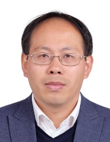


| 职 称: |
|---|
| 职 务: |
|---|
| 学 历: |
|---|
| 电 话: | 010-82178102 |
|---|
| 传 真: |
|---|
| 电子邮件: | wanglm@aircas.ac.cn |
|---|
| 通讯地址: |
|---|
生态环境遥感/水文水资源遥感/极地环境遥感
1996/09-2000/07 吉林大学地球探测科学与技术学院 应用地球物理专业 学士学位
2000/09-2005/06 吉林大学地球探测科学与技术学院 地球探测与信息技术专业 硕士/博士学位
2017/08至今 中科院空天信息创新研究院 副研究员
2012/09-2017/07 中科院遥感与数字地球研究所 副研究员
2011/01-2012/08 中科院对地观测与数字地球科学中心 副研究员
2007/08-2010/12 中科院对地观测与数字地球科学中心 助理研究员
2005/07-2007/07 中科院中国遥感卫星地面站 助理研究员
其中:
2011/09-2014/09 科技部国家遥感中心 国际合作主管
2016/12-2017/12 英国地质调查局 访问学者
1.2019.01-2022.12 中国科学院战略性先导科技专项“广目卫星三极环境应用” 子课题负责人
2.2019.08-2020.08 海南省环境科学研究院委托项目“海南岛高位池养殖空间分布信息遥感提取” 项目负责人
3.2016/01-2018/12 中国科学院“西部青年学者”项目“新疆干旱区湖泊动态变化遥感监测及气候响应”,项目负责人
4.2014/09-2015/08 云南省科技计划项目“云南南方丝绸之路经济带建设规划研究及遥感技术应用示范”,项目负责人
5.2012/01-2015/12 国家科技支撑计划项目“漓江流域遥感动态评估与监管技术体系研究”子课题“漓江流域遥感动态监测与应用示范关键技术”,项目骨干
1.Liming Wang,Qinjun Wang.A new semi-empirical topographic correction method for optical remote sensing imagery in rugged terrain.Proceedings of SPIE - The International Society for Optical Engineering, v7841, n1, DOI: 10.1117/12.873155.
2.Aynur Mamat, Liming Wang※, Fang Yan. Spatial Evaluation of Environmental Suitability for Human Settlement of Kashgar, Northwest China. Fresenius Environmental Bulletin, 2018,27(9):5899-5907.
3.H Gao, L Wang※, L Jing, J Xu. An effective modified water extraction method for Landsat-8 OLI imagery of mountainous plateau regions. 9th Symposium of the International Society for Digital Earth (ISDE), IOP Conf. Series: Earth and Environmental Science,2016, 34(1), DOI:10.1088/1755-1315/34/1/012010.
4.Hui Li, Linhai Jing, Liming Wang, Qiuming Cheng. Improved Pansharpening with Un-Mixing of Mixed MS Sub-Pixels near Boundaries between Vegetation and Non-Vegetation Objects. Remote Sens. 2016, 8(2), doi:10.3390/rs8020083.
5.A Maimaiti, L M Wang※, J Zhang and Z L Song. Environmental suitability evaluation for human settlements in Bosten Lake Basin. IOP Conference Series: Earth and Environmental Science, v57, n1, International Symposium on Earth Observation for One Belt and One Road, EOBAR 2016.
6.Haixia Feng, Liming Wang※, Lin Zhu, etc. The Effects of Haze on the Measured Soil Reflectance and Drought Monitoring Models Based on Spectral Feature Space. International Geoscience and Remote Sensing Symposium (IGARSS), 2015-November, p2020-2023, 2015 IEEE International Geoscience and Remote Sensing Symposium, IGARSS 2015 - Proceedings.
7.Li, Hui; Jing, Linhai; Tang, Yunwei; Wang, Liming. An Image Fusion Method Based on Image Segmentation for High-Resolution Remotely-Sensed Imagery. Remote Sens. 2018,10(5),doi:10.3390/rs10050790.
……
……